Mersey VMS Base Metals Project
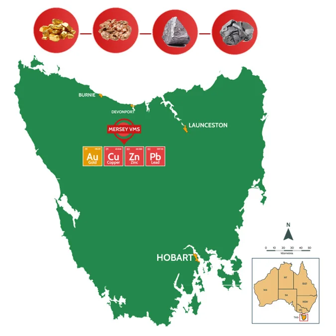
- Mersey Base Metals-Gold Project1 (EL6/2021) covers an area of 200km2 in the historical, world class mining area of NW Tasmania.
- VMS mineralisation model similar to nearby Hellyer Mine 16.9Mt @ 13.8% Zn (NQ Minerals) and Rosebery Mine 54Mt @ 11.2% Zn (MMG) deposits within the Mt Read Volcanics.
- 35km along strike from the Hellyer Mine area – displays similar geological settings to both Hellyer and Rosebery districts.
- Mineralisation Styles occur as:
– Shear hosted, steeply dipping stacked Zn-Pb-rich ore lenses
– Distal Cu and Au ore zones adjacent Zn-Pb-rich ore lenses - New insights and understandings into VMS systems and their controls have created new opportunities for exploration in Tasmania.
Multiple target areas:
- Cethana (Cu, Zn, Ag, Au)
- Lake Barrington (Cu,Zn,Ag,Pb) and
- Lea River (Au)
¹ AUH ASX announcement 27 May 2025 – “Investor Presentation May 2025”
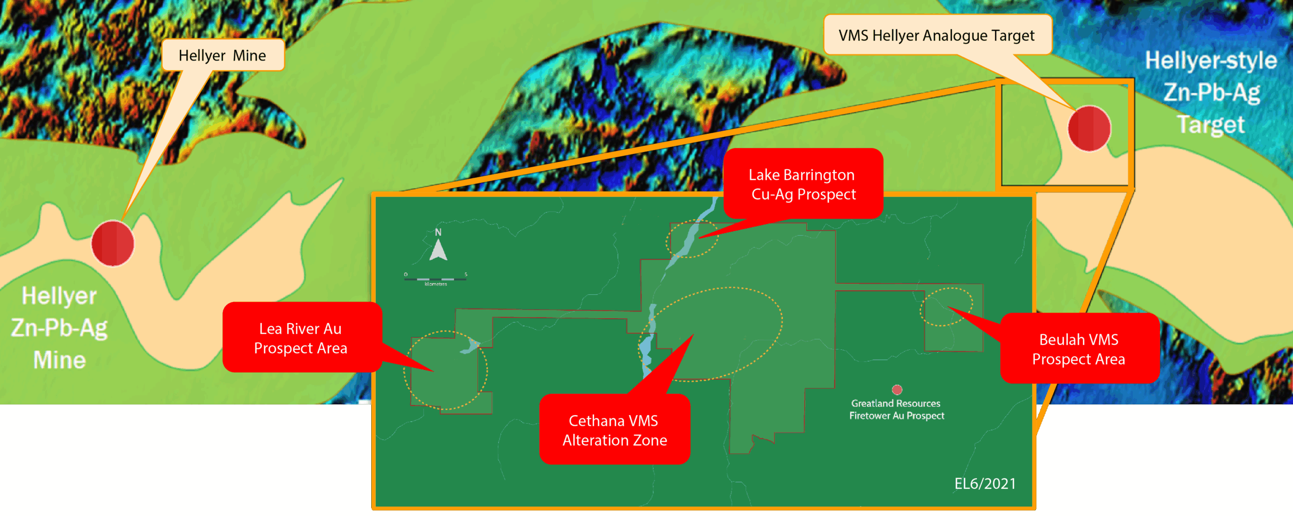
Mount Read Volcanics – host to the Hellyer and Rosebery VMS deposits, are located in the project area.
Mersey Project adjoins Greatland Gold’s (AIM: GGP) Firepower Au-Cu Project, sharing similar geology and hosting significant gold intersections, including 54.4m @ 1.3 g/t Au.
Magnetic 1VD imagery reveals a distinct magnetic zone, likely indicating a significant disseminated pyrite stringer zone in the footwall of the main mineralisation, supported by historic exploration data.
Planned exploration to include extensive soil and rock chip litho-geochemistry programs to vector mineralisation for drill hole targeting.
CETHANA
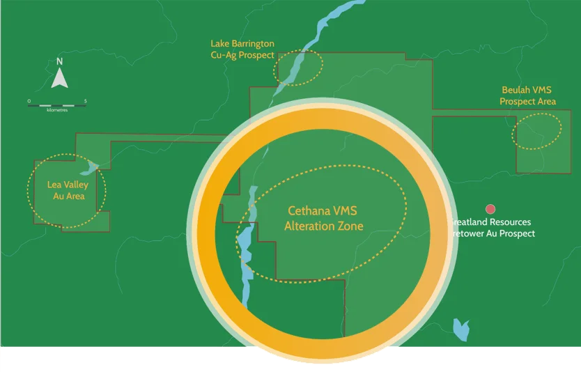
- Previous exploration by CRAE, Plutonic Operations, RGC Exploration, Aberfoyle, Newcrest and Pasminco identified, 8km-long, sericite-chlorite-pyrite alteration zone (Cethana Alteration Zone) hosted within felsic volcaniclastics and lavas.
- Lead isotopes taken from sulphide samples at Mt Roland and Gowrie (Aberfoyle, 1990) indicate similar results to Rosebery VMS Mine
- Area hosts anomalous base metal stringer mineralisation intersected in historic drilling and observed in mine workings – potential sub-seafloor replacement mineralisation, but may relate to evidence of structurally remobilised sulphides.
- Cethana East Prospect drilling (CRAE) include; 1m @ 1.1% Cu, 3.9% Zn, 185g/t Ag and 0.7 g/t Au (DD77CC5); 1m @ 1.3% Zn, 1.3m @ 1.4% Zn, 6 g/t Ag & 1m @ 05% Zn, 1% Pb and 7g/t Ag (CED2)
- Mt Roland adit rockchip sampling include; 1.7% Zn and 1.8% Pb (CRAE)
- Gowrie Park drilling (CRAE) best intersection; 9.4m @ 1.1 % Pb, 0.4 % Zn (D77GPC3) and 1m@ 1 g/t Au (D77GPC1)
LAKE BARRINGTON PROSPECT
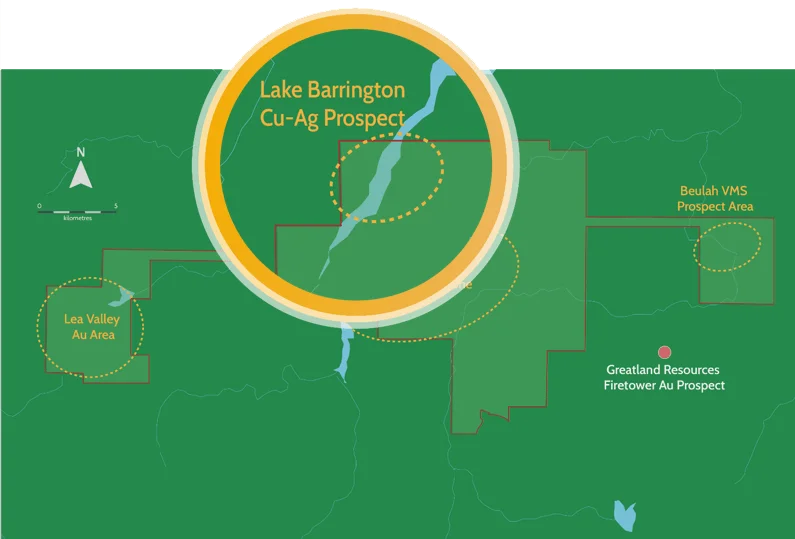
- Lake Barrington prospect identified by Asarco in 1974; CRAE completed mapping, rock sampling, magnetic and dipole-dipole IP surveys & two diamond drill holes.
- 3 anomalous areas defined by a 400ppm Cu contour, including a 450m long anomaly
- 4 Drill holes intersected dispersed copper mineralisation and one minor (±10 cm) semi-massive sulphide band. No further work was completed. Significant intersections included:
- DD80LB1 15.2m @ 0.38% Cu from 31.5m, 1.3m @ 1.32% Cu, 0.21% Pb, 1.02% Zn from 222.0m, 1.0m @ 0.36% Cu, 0.57% Pb, 0.85% Zn from 239.0m, 3.2m @ 1.17% Cu, 1.04% Pb, 0.70% Zn from 242.9m & 2.8m @ 1.41% Cu, 0.12% Pb, 0.61% Zn from 246.1m.
- DD80LB2 16.0m @ 0.31% Cu from 270m.
- DD82LB3 15.85m @ 1.17% Cu, 12 g/t Ag from 156.6m & 5.15m @ 2.45% Cu, 23 g/t Ag, 0.18 g/t Au from 167.3m,:
- DD83LB4 – 1.0m @ 1.86% Cu, 5 g/t Ag from 48m & 0.5m @ 4.78% Cu, 36 g/t Ag, 3.16 g/t Au and 515 ppm Co from 225.8m.
- Staverton prospect identified by Asarco in 1973 from stream sediment survey. Single percussion drill hole followed up IP survey anomaly completed by CRAE (1983) – broad intersection of 24m @ 0.9% Pb, 0.5% Zn, 9 g/t Ag. No other drilling completed.
LEA RIVER GOLD
Key target area is a co-incidental EM-Mag anomaly along the Kauri Fault south of the Blacks workings. IP line by Bass Metals (2009) also identified conductivity anomaly, interpreted to be potentially associated with pyrite associated with gold. This was not followed up with drilling.
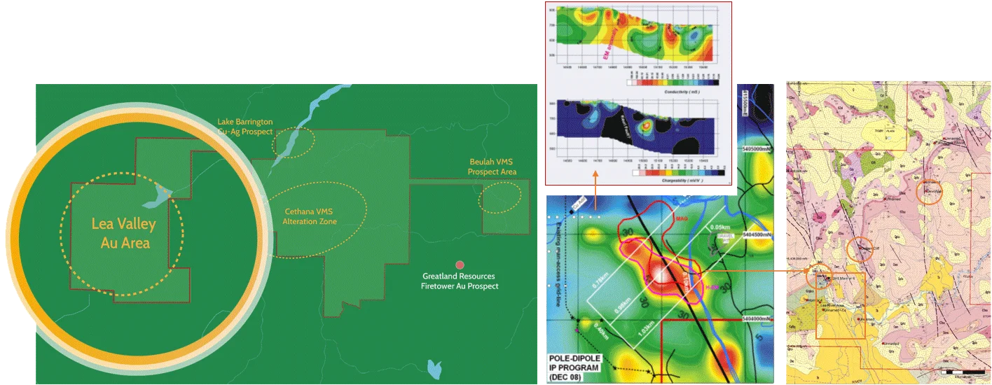
- Potential orogenic gold target; Lea River Gold area contains several old workings, with pyrite-quartz vein within shear zones contained in Ordovician sediments, along major NE structures.
- This included Blacks, Devonport and Gold Cliffs Prospects, with grades of 8 to 32 g/t Au identified in historic government production records. Geopeko (1974-1983) rock chipping and mapping yielded up to 68 g/t Au.
